Canada Country Map
What do you think of this template?

 (2.00/ 5)
8 ratings

 5 Slides
 File size: 16:9
 Fonts: Lato, Calibri
 Supported version
PPT 2010, PPT 2013, PPT 2016
Supported version
PPT 2010, PPT 2013, PPT 2016

Product details
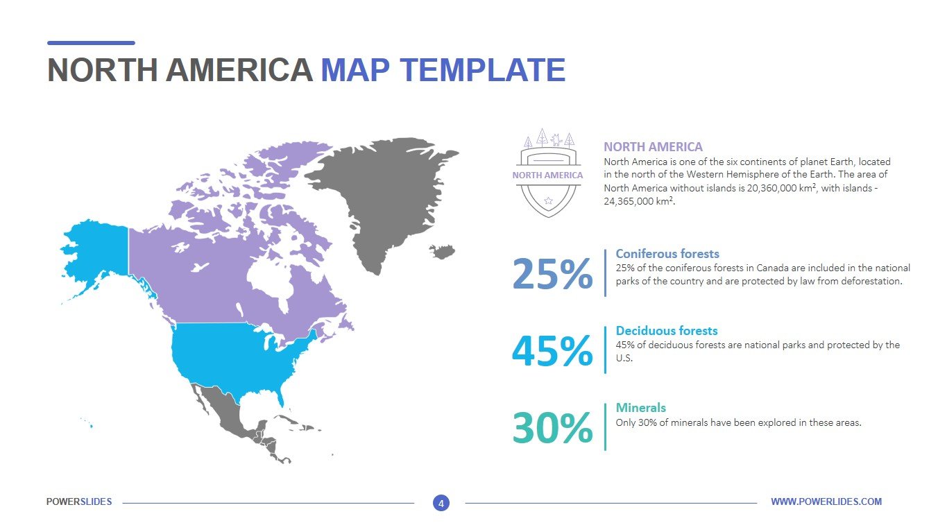
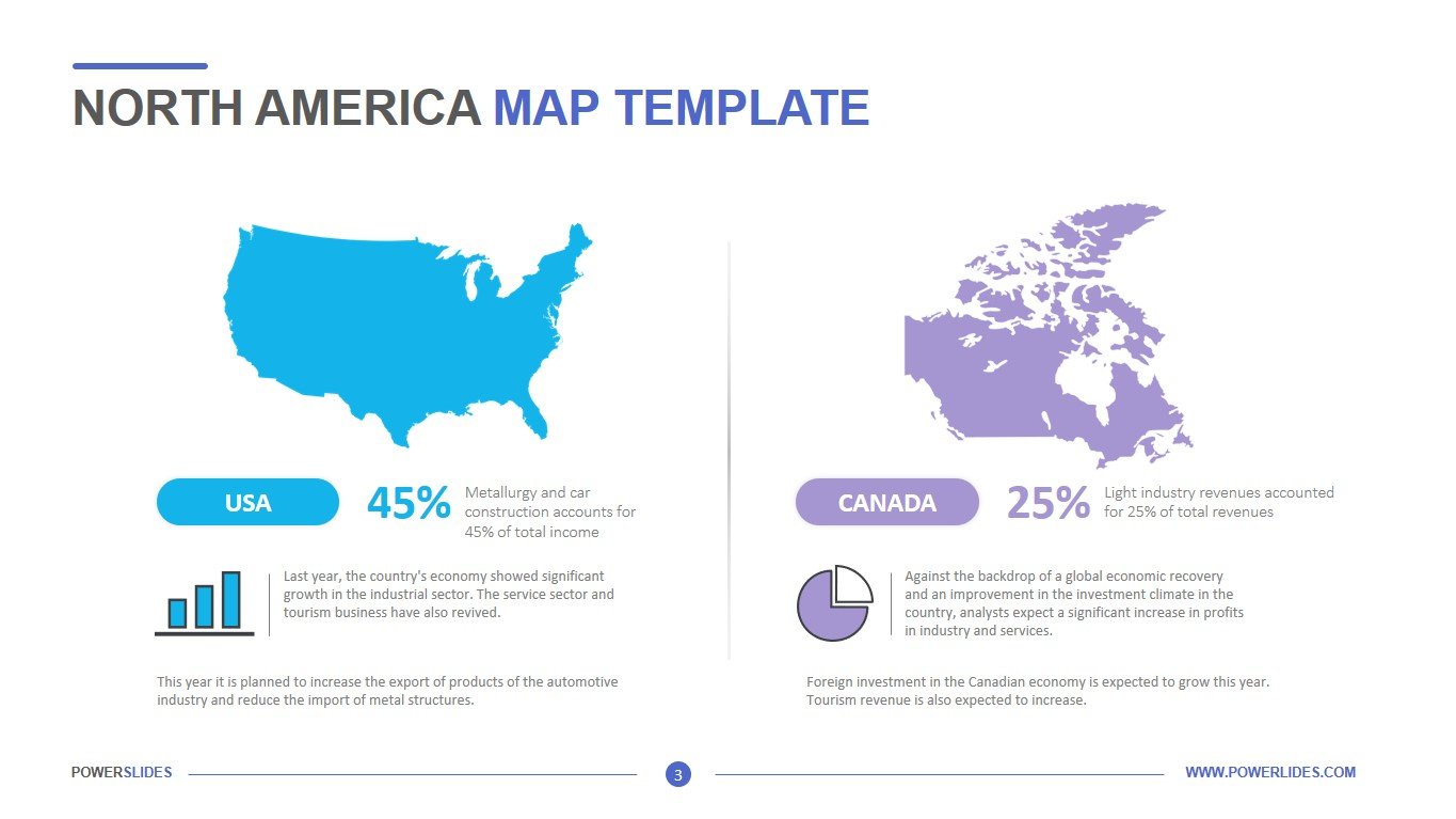
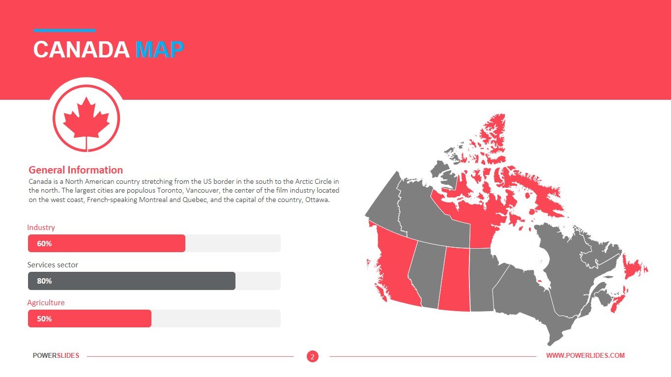
Canada is a North American country stretching from the US border in the south to the Arctic Circle in the north. The largest cities are populous Toronto, Vancouver, the center of the film industry located on the west coast, French-speaking Montreal and Quebec, and the capital Ottawa. Canada is divided into multiple geographical regions, and its landscape offers a wide range of natural sceneries. The Canadian Shield, the largest geographical area, encompasses half the country and centers on Hudson Bay.
Travel agencies can use the slides from this template when preparing travel itineraries for Canada. This template can also be used by public relations professionals when preparing information about the election campaign in Canada. School and university teachers can use the slides in this template to prepare their courses in geography and area studies. Environmentalists can use this template to prepare a regional environmental analysis for Canada.
This slide will be useful for sales managers in preparing their strategy for the development of sales in international markets. For example, you can use the slides in this template when preparing a sales analysis for Canada. Human Resources Managers can use this template when preparing information about a new employee from Canada or information about a company representative office in Canada. Also, this template will be useful for managers when planning their meetings when traveling to Canada.
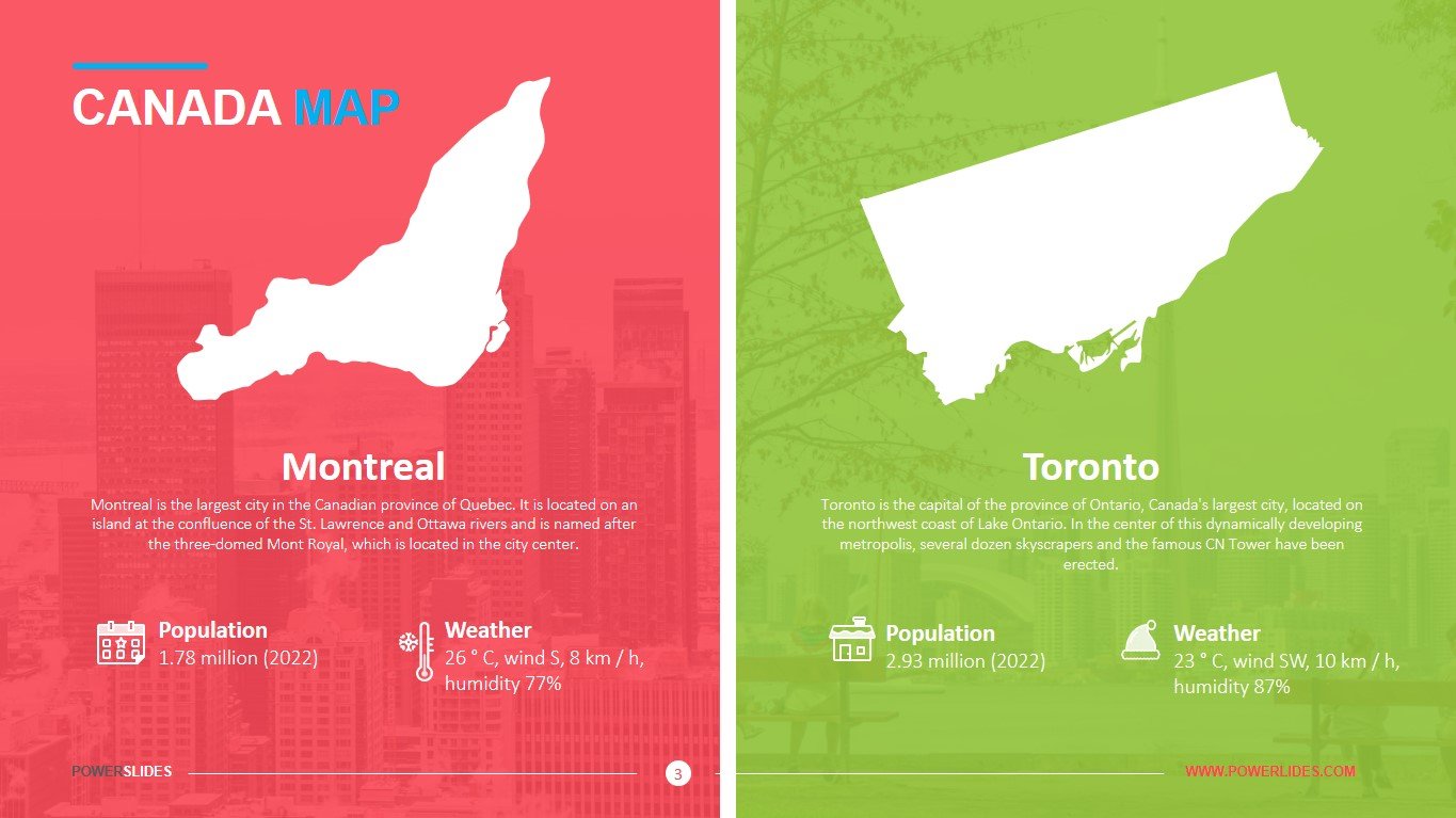
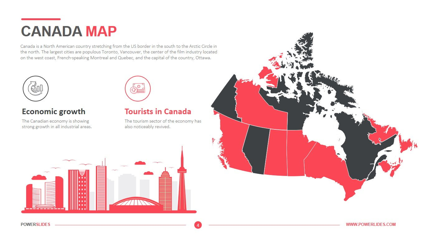
This Canada map template is for local use. Consisting of 5 slides, the template is completely customizable for writing the information you want to present. The first slide contains Canadian map with some highlighted points represented by climatic doodles on the right. A space for yearly comparison/prediction and dialogue boxes. The second slide consists of the Canadian map divided into two different colors constituting particular information. With the percentage bars of the related regions on the bottom left. The third side is the representation of the cities of Toronto and Montreal. With the space for writing city-related facts and dialogue boxes for things like local temperature, houses, calendar, and weather conditions. It can also remain in use for differentiation between the two cities. The fourth slide is focused on the business growth of the country. With economic-related pieces of information, it’s the best fit to represent market growth or urban, business planning of the Canadians. The fifth slide is a comparison bar chart along the vertical axes (parallel to horizontal axes). It can be used for representing monthly comparisons of any sort of Canadian data or information with the highlighted text on the top and description boxes on the bottom right.
Canada Country Map template contains all the tools you need to create a professional and modern presentation. If necessary, you can independently change the size and color of infographics, type and location of fonts in accordance with your corporate requirements. This template will organically complement your old presentations and will be a great addition to your collection of professional presentations.


